Organic Plausibility Checker
European Space Agency Project
Prevent and Detect Food and Beverage Fraud Feasibility Study
Short Description
Organic markets are growing all over the world. The frequency of organic food fraud is increasing as well. To counter this fraud, satellite-based new technology can play an important role. Our satellite-based Organic Plausibility Checker will act as a third eye for ensuring the extra surveillance in the organic sector combined with a supply chain mass balance system that combines certification and product transaction data.
Objectives of the Service
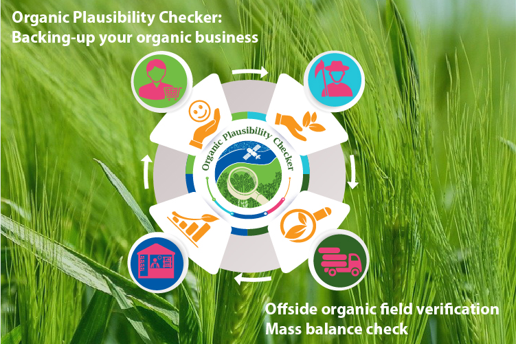
Organic Plausibility Checker aims to minimize fraud in the organic food supply chain and to increase trust in the sector. Combining satellite imagery with state of art Artificial Intelligence (AI) with a supply chain mass-balance system, we are providing the API that covers the remote monitoring of your field, check the organic integrity, and ensure the transparency of organic food from growers to consumers.
Users and Their Needs
Our potential customers are from the organic sector and from across the globe: certification and accreditation bodies, authorities, farmers associations and organic supply chain parties. With growing organic markets supply chains are getting ever more complex. Thus, ensuring the integrity of products is a huge challenge. Users need at least the monitoring of field sizes, yields, certification status of operators, and the product flow. In addition, the Covid pandemic underlined that stakeholders will increasingly introduce remote technologies for data gathering, inspection and surveillance.
Service Concept
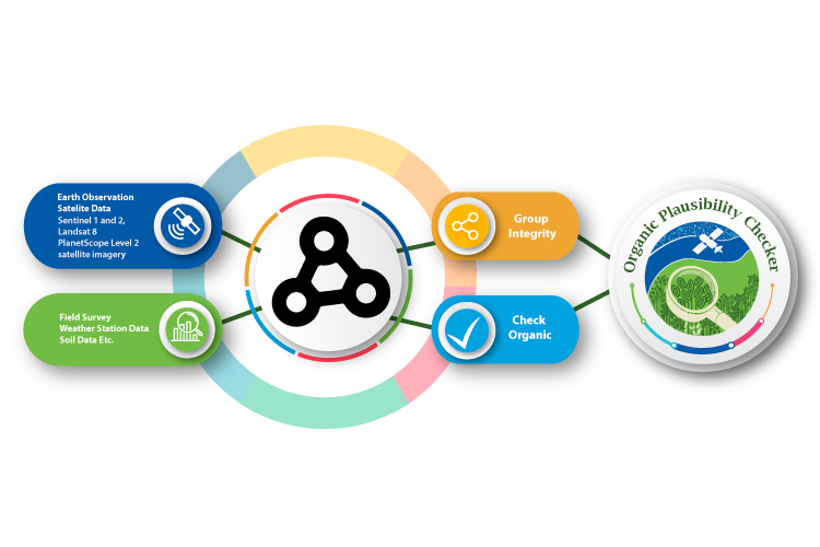
Organic plausibility checker will use a wide range of satellite imagery. Using medium resolution satellite data i.e., Sentinel-1, Sentinel-2, Landsat-8, GreenEO has developed a level 2 image processing technique. Additionally, we will use field level data, weather, and soil data along with AI technology to develop a model. Later we will use high resolution Planet Scope Level 1 satellite imagery to develop an image fusion technique for better coverage. Customers/users will get the final service in the form of an Application Programming Interface (API).
Space Added Value
Sentinel 1 and Sentinel 2 satellite imagery will be accessed from Copernicus mission, Landsat 8 satellite imagery from NASA mission. Our users and stakeholders will use GPS and other navigation systems for providing us the organic field location data.
Using of earth observation data, our API will enable customers to authenticate their data which will prevent the likelihood of fraud.
Project Partner
Hello, i would like to ask how to link this technology to a farmer’s PGS in Zarraga Iloilo Philippines in terms of digital data storage of traceability for organic black rice production. How do high school students help in helping famers transform handwritten data to digital data of organic plausibility checker
Thank you very much, Myla for your interest. You will be contacted as early as possible for further explanation to you.